High-density development that enhances neighbourhood connectivity
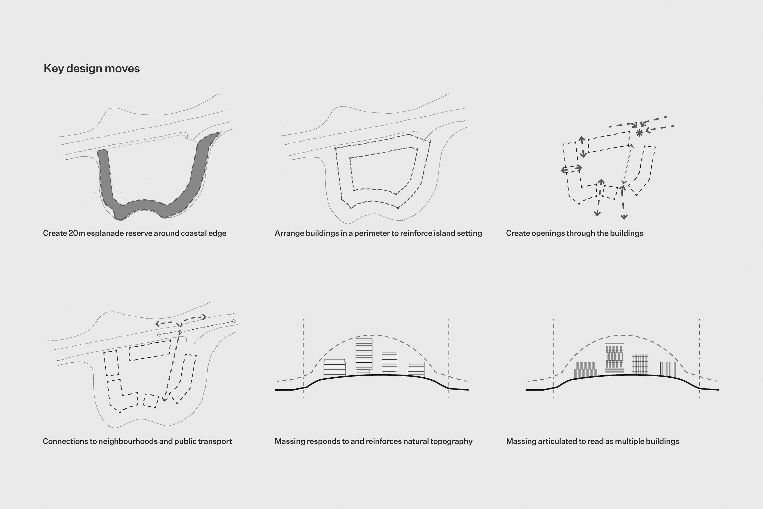
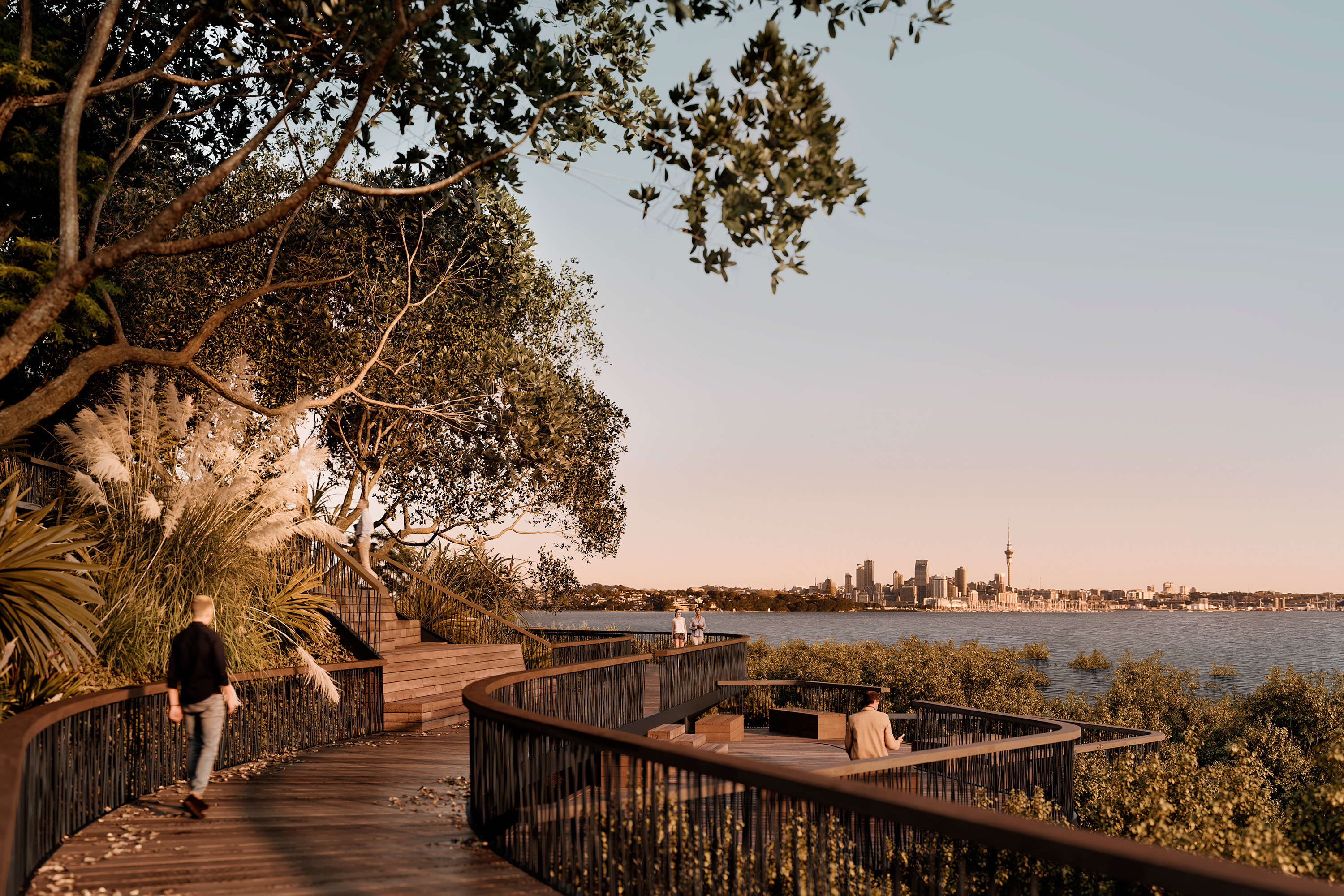
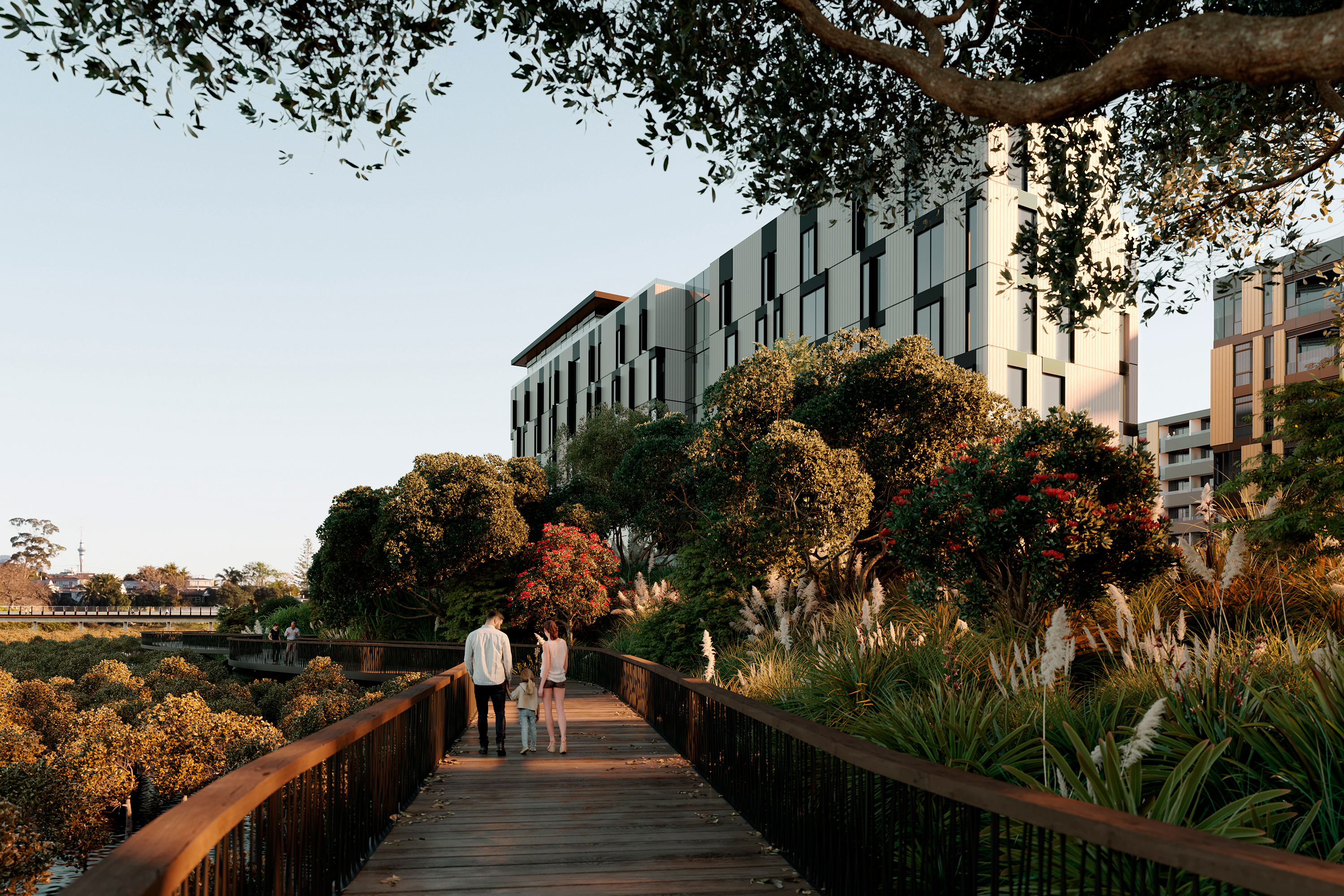
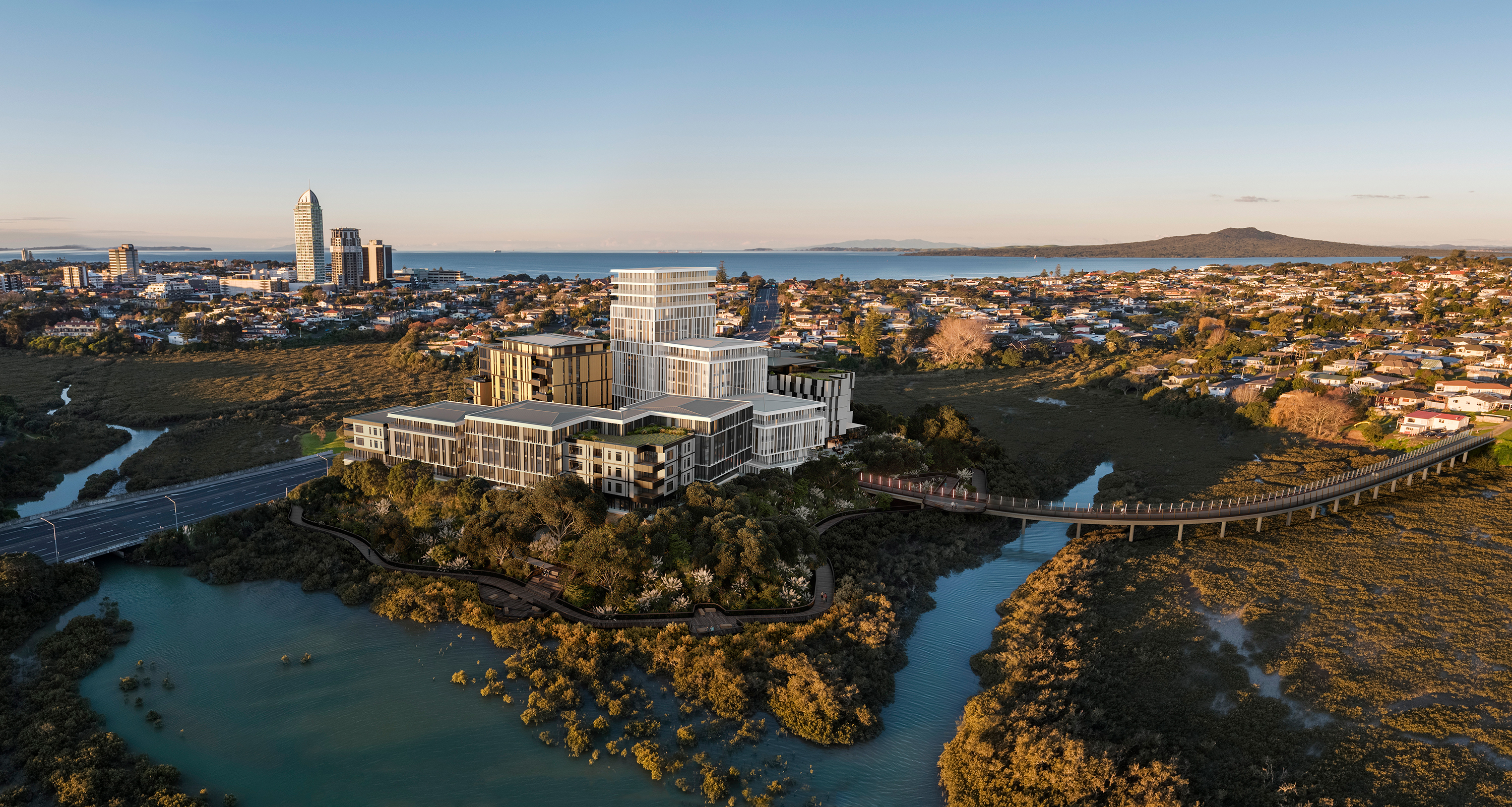
Surrounded on three sides by tidal mangroves, the elliptical site rises to a height of 10m above sea level from the water’s edge. A 20m coastal reserve has been set aside to become an esplanade, providing public access to the water’s edge via a boardwalk. Along with new public open spaces, a walking and cycling connection across the mangroves to Hauraki peninsula has also been proposed, in line with Auckland Transport and the local board’s proposal to improve connectivity to Esmonde Road, Barry’s Point Road and nearby Akoranga Bus Station.
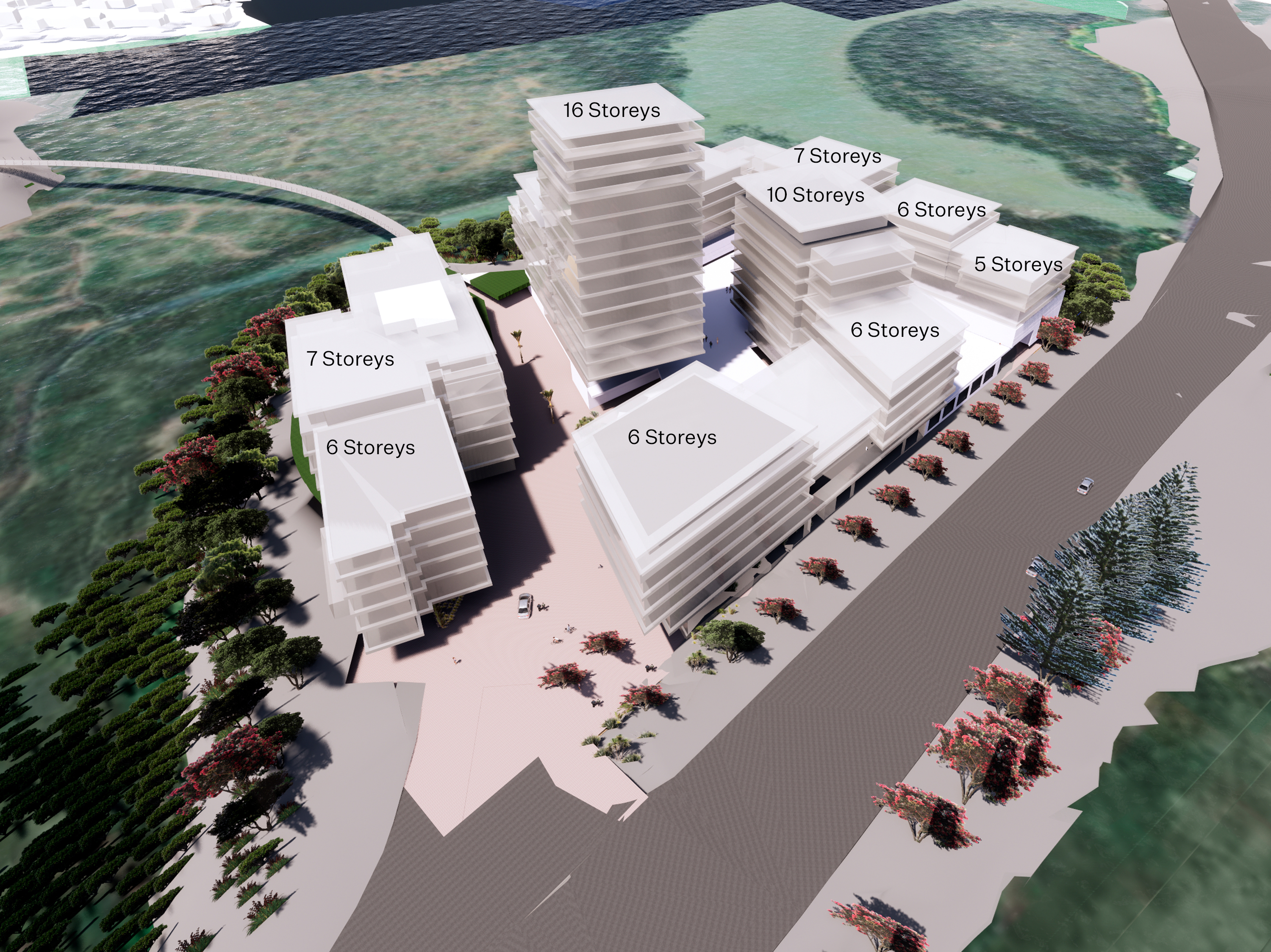
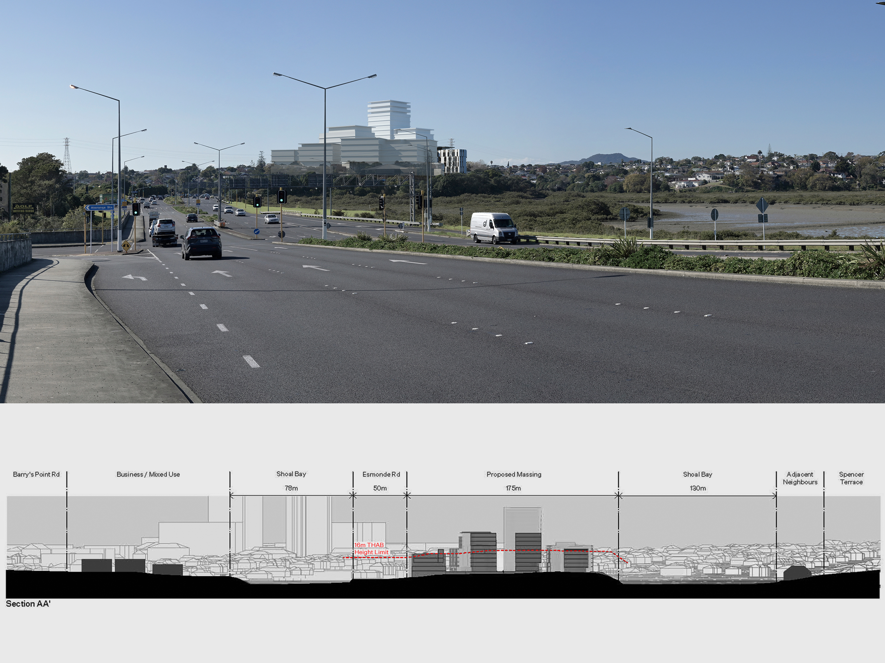
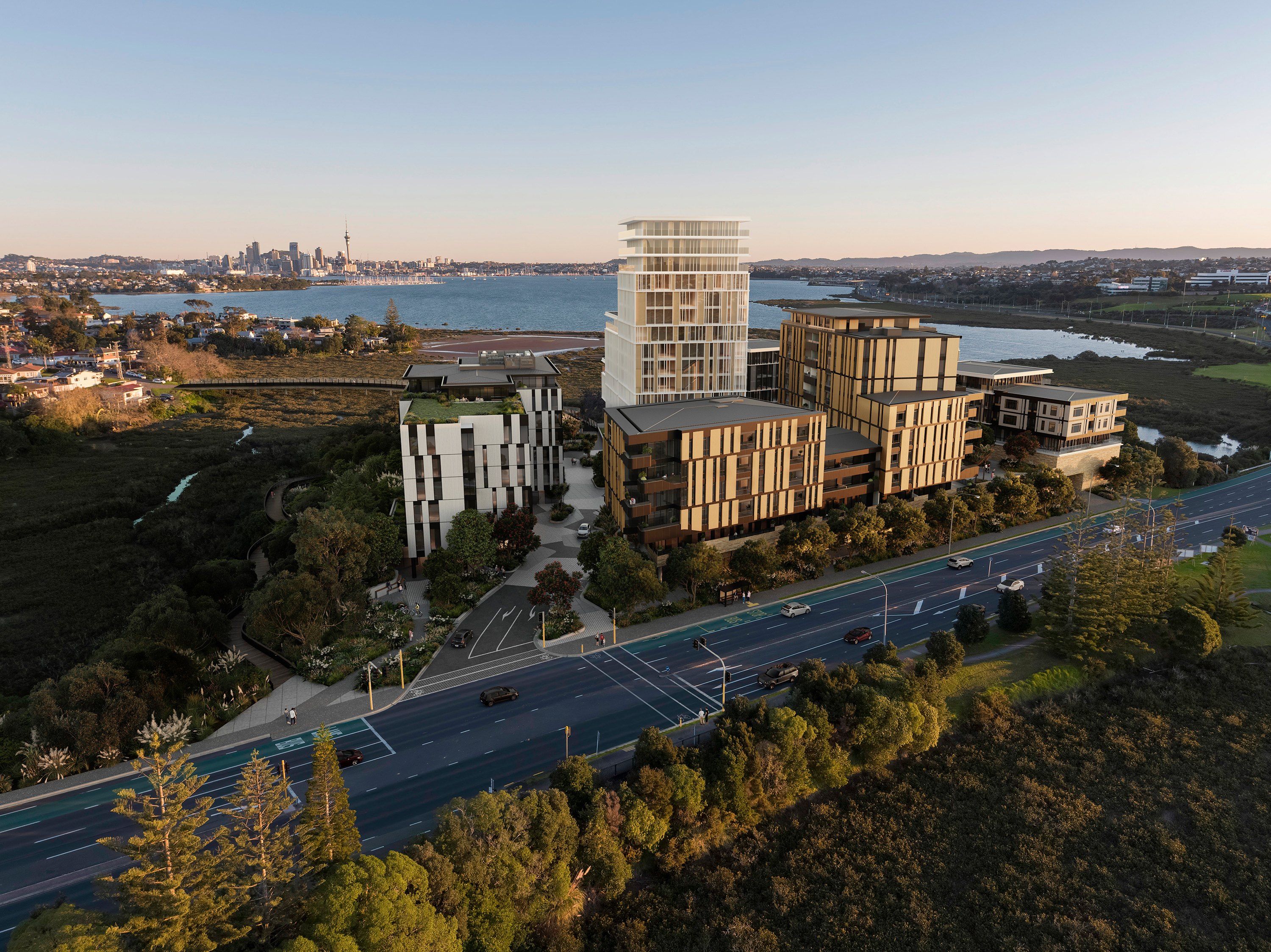
With taller structures occupying the centre of the site, the massing of the new buildings reflects both the volcanic nature of the isthmus and the Indigenous forest that covered the site in pre-European times. Generous spacings between new buildings avoids the development appearing fortress-like and protects views for residents.